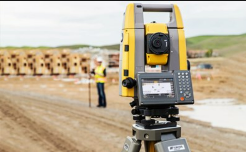
Surveying is a branch of engineering that deals with determining the relative position of different features on, above, or below ground level. Surveying deals with both measurements horizontal and vertical.
Classification of Surveying Could Be Done in Two Ways
There are two basic types of surveying.
- Primary Classification of Surveying
- Secondary Classification of Surveying
Primary Classification of Surveying
-
Plane Surveying
Plane surveying is used for small projects and small areas. We know that the earth is oblate spheroid in shape and hence while doing measurements we should account this feature into consideration.
But, for small projects, we can neglect the spherical shape of the earth. As the error is negligible, it is reasonable to employ plane surveying. -
Geodetic Surveying
It considers the curvature of the earth in calculation and measurement. This is used for making the map of counties, locating topographical features of the earth, etc. Geodetic surveying is conducted by The Survey of India department and is used for an area of more than 250 square kilometers.
Geodetic Surveying is also called triangulation surveying.
Secondary Classification of Surveying
Based on Instruments
- Chain Surveying
In chain surveying, only linear measurements are taken. Chain surveying uses ranging rods, chains, pegs, arrows, and tapes.
Read Also – Types of Chains Used in Surveying - Compass Surveying
Compass surveying is done either by the surveyor’s compass or prismatic compass. It is used to take angular measurements.
At present, there are two types of compass used widely in the field.- Prismatic Compass
This compass measures Whole Circle Bearing of a line. The prism is used to obtain readings in prismatic compass. - Surveyors Compass
This compass measures Reduced Bearing of a line. It has no prism on it. Reading is done with the naked eye.
- Prismatic Compass
- Plane Table Surveying
In the plane table surveying, data is directly plotted on the drawing sheet. It is a very quick method of plotting the drawings though less accurate.
- Theodolite Surveying
Generally, theodolite surveying is used for traversing. There are two different types of theodolite available, first is transit type and the second is non-transit type theodolite. The accuracy of angular measurements is higher as compared with compass surveying.
- Tacheometric Surveying
Tacheometry is the branch of surveying in which the linear measurements are calculated by taking angular measurements. Theodolites are used for this purpose.
- Photographic Surveying
This type of survey used the preparation of maps with photographs taken from a plane or a drone. It is also called photogrammetry and is used for preparing topographic maps.
Classification Based on Methods
- Triangulation Surveying – This type of survey divides the area to be surveyed into smaller triangles.
- Traverse Surveying – This type of survey is done for a smaller area. There are two types of traverse, closed traverse, and open traverse.
Classification Based on The Objective of Surveying
- Geological Surveying – A geological survey is a systematic study of a region’s geology, topography, and mineral resources.
- Mine Surveying – The practice of this type of surveying involves determining positions of points on or below the surface of the earth.
- Archaeological Surveying – It is to study the monuments. Archaeological survey gives details about ancient structures.
- Military Surveying – This is done only by the government for military purposes.
Based on The Nature of The Field
- Land Surveying
Land surveying is further divided into the following classes.
- Topographical Surveying – It is done to determine the natural features of the country
- Cadastral Surveying – This is carried out to determine the boundaries of field, estate, house etc.
- City Surveying – It is done to locate streets, water supply pipes network and sewage pipe network
- Engineering Surveying – It is done to prepare map of project.
- Hydrographic survey
It is related to determining the features of the surface of the ocean. Buoys and sounding poles are some of the basic instruments used in this survey.
- Astronomical Surveying
It is related to locating the position of ground points based on the position of stars in the sun. Many times the astronomical survey is used as a verification method.
Read Also-
Plane Table Surveying – An Explainer
Basic Principles of Surveying | Fundamental Civil Engineering
Highway Alignment and Its Requirements – A Detailed Study
Classification of Surveying Chains
FAQs
Parallelism is the principle of plane table surveying.
There are two types of traverse, namely the Closed Traverse and the Open Traverse in surveying.
ATR stands for Automatic Target Recognition in Total Station Surveying.
