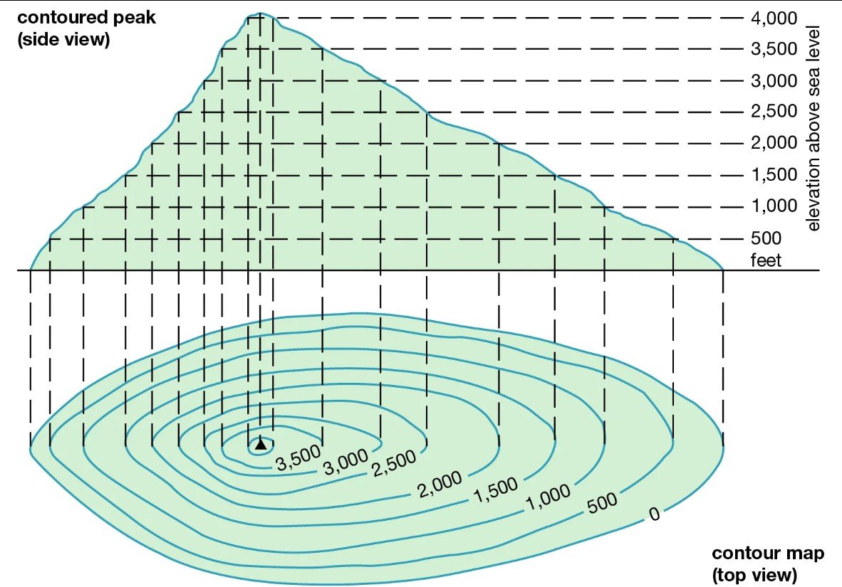
A Contour Line is a line joining equal elevation on the ground.
Contour Gradient
Contour gradient is the rate of change in elevation along a contour line. It’s a measure of how steep or gradual the slope of the land is between contour lines.
Contour Gradient refers to the steepness or slope of the terrain as represented by contour lines on a map. It indicates how quickly the elevation changes over a given horizontal distance.
A steep slope will have contour lines that are closely spaced, while a gentle slope will have contour lines that are farther apart.
This concept is to understand the topography and planning various activities and facilities like hiking, construction, drainage, and urban development.
Read Also- Average Salary of Civil Engineer in USA
How to Calculate Contour Gradient?
To calculate the contour gradient, use the formula:
Contour Interval
The contour interval is the vertical distance or difference in elevation between successive contour lines on a map. It is a constant value and is usually indicated in the map legend.
The contour interval helps to determine the elevation of a specific point and understand the overall topography.
Importance of Contour Interval
Accuracy: The contour interval affects the accuracy and detail of the map. A smaller interval provides more detail but may clutter the map, while a larger interval simplifies the map but may lose some details.
Map Reading: Knowing the contour interval allows you to estimate elevations and slopes. For example, if the contour interval is 20 meters, and you count five contour lines between your starting point and the peak, you can deduce that the peak is approximately 100 meters higher.
Characteristics of Contour Lines
- Contour lines form closed loops, either within the map boundaries or off the map.
- The difference in elevation between successive contour lines is constant and is known as the contour interval, which is specified in the map legend.
- Contour lines never cross each other. Crossing would imply two different elevations at the same point, which is impossible.
Read Also-
Basic Principles of Surveying | Fundamental Civil Engineering
Classification of Surveying Chains
Sokkia CX105 Total Station User Manual Download
SLT12 Android Total Station User Manual
Building Planning and Drawing Textbook
FAQs
An overhanging cliff is a geological formation where a section of rock projects outward from the face of a cliff or steep slope, creating an overhang or ledge. In Overhanging Cliff the contour lines of different elevations crosses each other.
A vertical cliff is a steep, nearly vertical, or overhanging face of rock, or earth. At Vertical Cliff two contour lines of different elevation unite to form one line.